
I. THE INTRODUCTION
A. Art of the Day
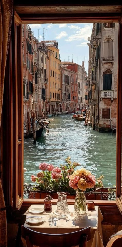
- My idea for a perfect Saturday brunch, sitting by an open window in Venice along the canals, fresh flowers gracing the table and balcony, the blue skies and 18th century buildings smiling back, gondoliers parked, an Italian meal awaiting, in this Atlantis of cultured living.
B. Wisdom of the Day
- Hubris infects the strong, not the weak; the clever, not the knave; the smart, not the illiterate; the previously successful, not the prior failed. It’s what makes it so inviting, so tempting, and so destructive — precisely because it infects the very people who need to be most immune from it.
C. Appearances
- Judge Napolitano
- Peoples Pundit

- Dialogue Works

- Daniel Davis
- Going Underground

- Mario/Brandon.
D. Daily Picks
E. Special Notices
- Special discount on SportsPicks subscriptions. Get all the picks on elections markets, economic markets, events markets, sports markets, plus exclusive AMAs, Masterclasses, and the best value in prediction markets anywhere, for less than $1/day and more than 50% off the annualized price. Discount code: 1776 https://sportspicks.locals.com/post/8098900/huge-discount
II. THE EVIDENCE: BARNES LIBRARY
A. Food & Medicine
- The Covid coverup continues. https://www.racket.news/p/the-fauci-legend-will-not-die
B. Economics
- They lie about made in the USA. https://prospect.org/2026/07/30/great-made-in-usa-fraudyssey-amazon-walmart-ai-chatbots/
C. Politics
- Labor left used to want limits on immigration. https://www.commonplace.org/p/roy-beck-a-civil-rights-icons-blueprint
D. Geopolitics
- Hamas will disarm if Israel leaves. https://www.cbc.ca/news/world/hamas-israel-disarmament-deal-9.7291822
E. Culture
- The musunderstood Orca.
*Bonus: Board Post of Note